
Mapping and GIS
GIS is a convenient and cost effective way to combine and analyze a wide variety of information from various sensors and inputs. GSC has developed the use of GIS on a many different projects and at various scales from miles to millimeters. We have experience with, and can provide data and information, in all common GIS formats to streamline client application and efficiency.
Some of our services include:
- Custom spatial database development
- Generation of spatial data layers
- Geospatial analysis of existing data layers
- Preparation of custom graphics and conversion of various formats
Mapping/GIS Projects
Featured


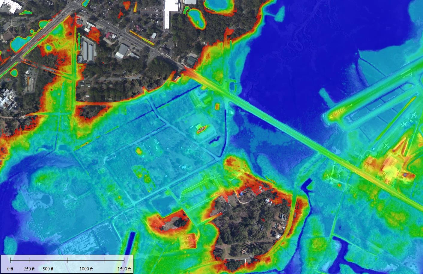


The North Coast project in Georgetown and Horry Counties (SC) grew from TNC’s Coast Summit in 2016 where riverine flooding was highlighted as a problem that held opportunity for nature based mitigation projects. Geoscience Consultants was hired to provide an understanding of localized flood risk at present and under future climate change. This information will help community stakeholders identify locations where green infrastructure can be used to mitigate increasing flooding issues.