Short Term Rentals - A Tool In the Resilience Toolbox?

We on Sullivan’s Island are paying attention to Isle of Palms’ debate on short term rental (STR) licenses. I am interested from a coastal resilience perspective. Management of STR licenses, like other rules, ordinances, and regulations, provides an avenue to bolster resilience, but like all compromises it is not without costs and considerations both at present and in the future.   

Read More

Charleston 2040 Sea Level – Add 1 Foot to 2020 Sea Level!

Like a lot (maybe all) of coastal scientists and researchers out there I am constantly considering how sea level rise (SLR) is going to change the results I am generating in the here and now. Along those lines, I just read an article about how FEMA’s maps are going to be off the mark as climate change continues to drive results from the known probabilistic toward the lesser known but continuing long-term trends. The processes driving SLR have been occurring for decades, but they have recently started to accelerate. That means we are not talking about new processes just quicker change.

An unavoidable fact is that today’s sea level (the average) is different than 40 or 100 years ago, i.e., there is a trend to deal with. This is not game changer, however, and we still move forward with predictions, planning, and engineering to name a few. We don’t need to predict the sea level perfectly – that is not even an option, the variability of the natural world makes certain of it (keep reading).

For example, I am looking to define within about 5 -10 cm (a few inches) what the water levels will be in 2040 for the Charleston, SC area. Many would agree that it depends on what curve you use; I can hear you saying, “go with the lower intermediate”. Anyway, picking from about six curves means it is basically rolling the dice and that means getting emotional (I favor the lower intermediate because …), which I am trying to avoid. I want to use the data we have gone through great lengths to collect and verify to define the near future.

Here are the over-view of results from the local tide data – for more details on process see the white paper.

1. Sea Level will be at least 1.3 feet higher than the present datum in 2040 (it is already like ½ foot)

2. Sea Level could be 1.5 feet higher than the present datum in 2040. That is on the NOAA Intermediate-High curve for Charleston and a good planning level for 2040.

3. Monthly variability (1 standard deviation) in mean sea level is on the order of 0.4 feet.

4. Present sea level is accelerating at 1.0 cm/year; by 2040 that will be 1.5 cm/year.

5. Marshes in the SE have a hard time surviving sea level rise beyond 1.25 cm/year.


Shallow Groundwater Levels and Flooding from Rainfall

There has been lots of talk of SLR and flooding from storms and Spring tides (King tides). Another aspect of climate change is precipitation increases (or decreases) and how that will affect our present infrastructure. In coastal areas of South Carolina these two aspects of climate change can or could present together to bring on larger changes than when speaking of them separately.

Read More

Use of Historic Shorelines to Re-Create Synthetic Topography for Risk Analysis

In an earlier post (Feb 26, 2019) I highlighted some work using statisitics from lidar data sets along with SLR to define the risk of shoreline locations and to use that to define how to vary renourishment volumes to maintain a chosen equilibrium beach width.

Now working on Sullivan’s Island beach that has very distinct trends and no history of any significant renourishment I decided to try another way to capture the trend aspect as the primary variable. The white paper highlights a way of taking historic shorelines to the next level of analysis. This model of historic and future shoreline morphology is based on the use of shorelines and multiple sets of lidar data; the model can be run forward and backwards in time and used for a wide variety of analyses.

Read More

Sullivans Island Coastal Analysis - Fun On A Beautiful Beach

Geoscience Consultants has recently moved its office to Sullivan’s Island South Carolina. This brings all kinds of fun opportunities to get out there, learn, analyze, and hone the observation skills. To share this information I have started an on-line site that highlights some of the more timely coastal processes and their effects on Sullivan’s Island. I will be bringing in as many data sets as I can to describe the processes and changes that occur, along with the implications for homeowners. I will, at times, push the envelope to test analysis techniques but also try to describe it in as ‘normal’ a fashion as I can. My online mapping skills are presently so-so, and I will be doing what I can to 1) get better at it and 2) bring interactive near-real-time mapping to Sullivan’s Island. You can skip ahead to the site or continue reading below.

Sullivans Island erosion - c. 2020

Sullivans Island erosion - c. 2020

So, the backstory - and there are always backstories - as to what has kinda spurred this effort is that Sullivan’s Island (SI) has an apparent and unfortunately real ‘issue’ with an historically accreting beach, although that historic trend is likely to change (if it hasn’t already). How is that an ‘issue’ you may rightfully ask, well if you want to live ‘on the beach’ it can be. The town is being divided by the idea of what homeowners want in beach living. Some want to feel and see the ocean and some want a level of coastal resilience and natural coastal habitat. I get it, and I think it depends largely on your temporal (length of time) viewpoint.

If I go on vacation to a hotel on the beach, well, I want the wind in my face and to see the ocean and waves on the beach. If I live in that hotel on the beach, maybe I am a bit less adamant that I feel the wind and see the waves rolling in every day. If I stretch my temporal view and want my kids to enjoy living in that hotel as I have, I would want a big buffer between the hotel and the wind and waves.

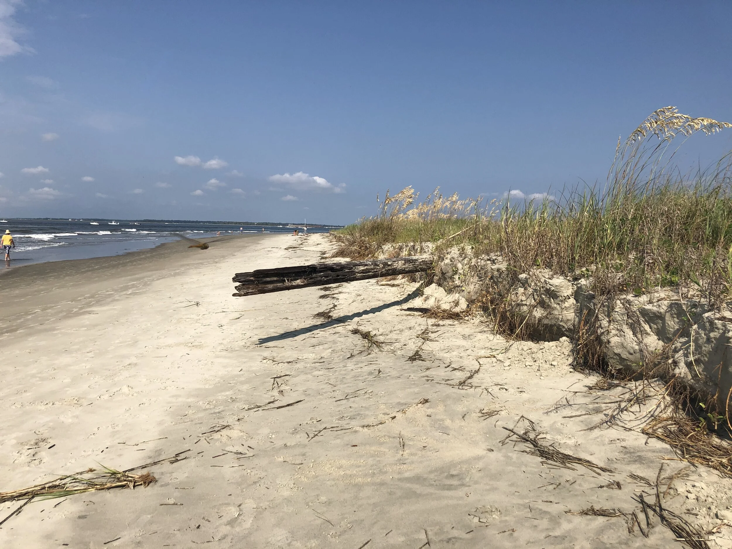
I am in the second or third category and have classic training in the evolution of barrier islands - which is what Sullivan’s Island is. Barrier Islands change, the actual land area of Sullivans Island cannot really be measured accurately. Barrier Islands accrete and they erode (daily); they move. This is no surprise, we have all seen the features that indicate this and is what makes a walk on the beach new and interesting each time. Unfortunately, however, I think the idea of assuming this island is generally accreting has lowered our guard. Sort of like thinking the Corona virus would stay in China.

Change is part of the draw but it is also something we have to be mindful of. Linear trends are one thing, but when you insert human induced change into the mix, and I am not purely talking about the climate, there can be non-linear, or unexpected, change. That is essentially how we got here; it is large part due to the Charleston jetties that Sullivan’s Island has benefited and grown seaward; the island accreted between the 1940’s and 2000 on a massive scale. Great for Sullivan’s, not so great for Folly and Morris Islands. Maybe that is/was true, but next comes dredging to keep that channel open, and in this case a very deep channel. What happens to Sullivan’s Island, which is only a couple hundred meters from that very deep channel, when it is artificially maintained to a new depth and with a potential increase in the tidal prism?

These are among the things I hope to address in this work - especially now that the Corona virus is keeping us at home. My goals are to look at 1) Shoreline Change now and into the future, 2) inundation risks now and in the future, and 3) changes to the back-side of the island in the form of marsh migration. To keep this ‘Blog’ tidy I am setting up a separate site where you can follow the data and analysis if you are interested. You can find it HERE. Also, if you have any specific questions - please send along to keil@geosciconsultants.com and I will try to tackle it with real data and analysis.

Barrier Islands and Ebb Dominated Deltas: Implications of SLR on Shoreline Change

Living on a barrier island in South Carolina, the importance of currents becomes obvious. There are significant sections of the beach near my house (Sullivan’s Island) that are off-limits to swimming because of the dangers. There is a navigation buoy just off the beach that during ebb tides is almost sideways. I am guessing there is four plus knots of current there sometimes – not quite Woods Hole, but close. Anyway, enough to easily shape sedimentation patterns.

Not surprising the inlets between islands in this part of SC are ebb dominated (see image below). They control sand bypassing events and act as a large subaqueous sand source (Kana et al., 2013). During erosional events the sand is temporarily stored in the ebb deltas and conserved within the littoral zone, i.e., it is not lost from the nearshore system. For the continued stability along these ebb-delta-controlled islands the inlet dynamics are on par with the wave climate (Hayes, 1979). Behind the barrier islands (Sullivan’s Is., Isle of Palms, and Dewees and Capers Islands) are large expanses of marsh, tidal creeks, and the intra-coastal waterway; there is a lot of water that has about a six foot tidal range and needs places to ebb out.

Breach Inlet and ebb delta - Note the expanse of sand extending from the northern island - Isle of Palms.

Breach Inlet and ebb delta - Note the expanse of sand extending from the northern island - Isle of Palms.

In recent years the island to the north (Isle of Palms) has had a couple of renourishments adjacent to the ebb delta on the it’s north end. This is concerning for the people who live in the immediate area ($ for renourishment) and for the rest of the people living on these two inhabited islands. What it suggests is that the ebb delta is not bypassing at the same rate as in the past and it needs a costly push to maintain previous levels. I understand the data is not conclusive on the change in bypassing cycles, but it is a red flag in my book.

This takes me back to the currents and all the water tied up behind the islands, much of it in marshes. Unlike a lake, bay or open water the amount of water held in the marshes is not a linear function. So, when SLR is inserted in the equation (say a rise of 30 cm) the net change in flow is not zero in a marsh setting. See Schematic Below:

Schematic of water volumes in marshes

Schematic of water volumes in marshes

If you measure the volume between the upper and blue lines, i.e., the “present” tidal envelope, you will have an estimate of the amount of water stored in the marsh that will ‘flush’ out during a tidal cycle. Similarly, the volume between the purple lines would be the hypothetical volume from the marsh under SLR. And, I think you can see that if all the water was in channel, the difference would be a net zero, and this would be a non-issue.

Unfortunately, of fortunately, the additional water must flow back out of the inlets – resulting in an increase in velocities (more water, same time and outlet geometry). An important point here (!!) - I am not assuming any vertical marsh accretion, and also assuming that the inlets are stabilized.

This gets me back to coastal dynamics on the beaches; I wanted to see how much change in ebb delta velocities we are potentially looking at. My unfortunate professional opinion is that increasing the seaward directed velocities will flush more sediment out of the system to deeper water, thus making it ‘less available’ for bypassing.

Practical Example:

I pass over Breach Inlet (between Sullivan’s Is., and Isle of Palms) almost daily on my bike – part of my COVID-19 exercise regime – and decided to look specifically at how much change in water volume could occur here. It is very much a stabilized inlet. So, I did some watershed analysis of the marshes behind the islands with the help of some hydrologic enforcement on the VDATUM surfaces; it is not specifically correct but provides some reasonable boundaries.

Figure 1. Watershed analysis of marshes to the west of the barrier islands. Pink area is ‘theoretical’ drainage to Breach Inlet.

Figure 1. Watershed analysis of marshes to the west of the barrier islands. Pink area is ‘theoretical’ drainage to Breach Inlet.

You can see that the drainage to Breach Inlet (pink area) is hypothetically all from behind Isle of Palms. This is not an overly important point as these marshes are fairly ubiquitous. Anyway, I computed the volume in that pink area at present tidal conditions (i.e., 1992 tidal epoch) and with 0.3 m of SLR, which is almost what we are looking at in 2020.

I computed the volume of water in the pink area at MLLW and also at MHHW and then subtracted the MLLW from the MHHW volumes (as was done in the blue lines in the schematic). Likewise I computed the ‘purple’ lines in the schematic, namely the MLLW + 0.3m and MHHW + 0.3m (Table 1). The important figure here is that the increase is 27% more than present. I would expect that percentage to be roughly the same regardless of the specific area feeding Breach Inlet.

Table 1. Volume calculations from “pink area” in Figure 1.

Table 1. Volume calculations from “pink area” in Figure 1.

This leads to three big questions:

1) does 27% represent another regime (inlets are no longer functioning as in the past) or is it a modification that will change the specifics but not the system;

2) will overall water volumes be re-routed - and what affects will that have; and

3) what is the rate of marsh accretion (I am guessing it is less that SLR) and do we need to help it out in order to keep the inlet functioning.

I apologize, I don’t know if leaving this off with questions is the right way to go, but feel free to contact me if you have any thoughts. My two cents is that 27% is a big deal and we should start to ask ourselves if SLR is doing more than just causing linear erosion (shoreline retreat); and saving these islands has more to do with the totality of the surrounding environments (like we are finding with COVID-19) than just adding sand to the beach.


Measuring Shoreline Change Using Statistics - A Different Way To Look Toward the Future From the Past

I recently gave a presentation on a different way to calculate shoreline change and forecast future shorelines at Coastal Geotools ‘19. It is not the typical 1D analysis that we have all done - including the work I have referenced before using the nearest node technique. This 2D technique is based on probabilities and has never been used in any study I have seen. That said, it may be a bit before its time but I thought I would share it and hopefully it will raise ideas and questions - and please do hesitate to ask me if you want (keil@geosciconsultants.com). I have two links - one is a short paper and the other is a presentation.

Standard Deviation of 20 years of shoreline elevations.

Standard Deviation of 20 years of shoreline elevations.

Hurricane Florence – Can Politicians Learn From Their Own Success

This is a bit different, non-technical, entry, but hopefully it makes sense for how science and the future are dependent on each other.

So, I am located just outside Charleston, SC and Hurricane Florence just came ashore in Wrightsville Beach, NC – about 150 miles to the north. Today is Friday and we have been told since Monday that we are under Mandatory Evacuation orders. I have no issue with this, and understand that it is better to be cautious than not. I chose based on my reading of the models and NOAA’s mapping that in all likelihood the storm would hit NC, and they were only off by a couple of miles. Fantastic work from all involved. Some models did predict a crash course for Charleston, but in general the bulk did not, the consensus of the scientists/experts was spot on.

historical_florence.png

The Governor of SC wisely listened to these scientists as did the Governor of NC even though this storm was outside of the norm (more northerly track in black above) for all similar storms that came off of Africa ended up in same area of NC/SC. The models, like I mentioned, got it right even though the historical data was in disagreement. The Governors were wise in listening to the people who run and use the models, even if they over-reacted in my area. Did the ‘overly cautious’ reaction cause loss of revenue in most of SC – you bet – but kudos to our governments for taking action in the face of uncertainty that puts safety over costs. This why I am completely flustered/confused/etc. by our governments – especially in SC/NC – lack of action in the face of climate change.

It is the same people, using models of even higher power, who are predicting changes that the past history can not replicate. It is an analogous situation, but has a completely different course. If this hurricane preparation was a success in the eyes of the politicians – why are they following a completely different path on climate change. The science in either case is not perfect (see an example of model spread below), but the people who are familiar with the results can, and do, make sense of it. If the Governors of both states would have been following their path on climate change they would have chosen to follow history and assume Florence was going to recurve out to sea and be a non-issue; they would have been dead wrong.

model_tracks_flo.png

Instead they listened and got it right. My hope – and I feel like something good will come out of this storm – is that the politicians begin to feel better about science and see how it can make them better at their jobs – which in turn makes it better for us citizens. Hopefully this storm can help them see outside of their political blinders – well fingers crossed anyway.

Modelling Inundation Risk From Storms and SLR - A Presentation & Whitepaper

I read the Coastal News Today and on most days there is an article on SLR and the steps being taken to inform the public and plan for future conditions. Very seldom, however, do I see anything that includes a 'weather forecast' handling of what may occur. All too often it is the choice of a specific level of SLR and it is commonly different (beyond relative SLR variations) than the adjacent state or city. This apparent shortcoming in logic limits the public's ability to trust the message; I know I would wonder why institution A says SLR is going to be 2.0 feet by 2080 and institution B says 1.2 feet by 2060. They may both be reading from the same script but the math gets confusing.

I presented my thoughts on the logic shortcoming at the recent CERF meeting in Portland, OR this past fall (see link below) and also developed a paper on the Geoscience Inundation Risk Technique. I hope this idea of using shades of grey vs. wet - dry makes some sense and I think the logic of using % risk will catch on like in a weather forecast of rain chances for next week. No one expects next Friday's forecast to spell out the exact weather - but we have all learned to deal with some unknown.

It is Wrong, but what is the Risk that it is Right?

Shoreline Change Analysis of Complex Shorelines

Ok, so this is not a new topic and there are some really good references/studies out there; however most studies deal with beach/sandy shorelines. As time goes on and more lidar data is available - the analysis of complex or wetland dominated shorelines is sure to increase. Analysis of ‘noisy’ or complex shorelines can require fairly high level data analysis to smooth out the trends. The previous studies do a great job at discussing all of the different types of data analyses – how to take the shoreline measurements and define the shoreline change trends. This is good, but the discussions that I find kind of limited are about the different measurement processes and the description of shoreline error – can I measure the change differently (especially on complex shorelines) and do I recreate the same shoreline from the same data each time I digitize it or generate a shoreline from lidar data. So I figured I would concentrate on the measurement and the assessment of shoreline location error in this piece.

Read More

Deriving Inundation Risk Using Lidar and SLOSH Outputs

OK, so I have always wondered how to deal with the MOMs from the SLOSH program since it really is a worst case scenario for each hurricane category; and not likely going to come into play (thankfully). Then there are the MEOWs (maximum envelope of water) for each direction and speed – which is quite a few options. They give you a glimpse of a ‘normal’ hurricane strike if you choose the correct speed and direction, which can be attained to some degree from historic hurricane tracks. Then there are tides that also complicate things, which gets me back to my leading question, how to use this information to map present and future risk. The data is there, and it seems ready for consumption. To see how I worked through it - please read on.

Read More

Use the Lack of Information to Generate Better Shorelines

Lidar is inherently or, maybe I should say theoretically, a great way to generate shorelines at specific tide levels. The National Ocean Service (NOS) has done a lot of work on this and have the specifications down to produce the best shoreline possible; however, there are hundreds to thousands (??) of coastal lidar data sets that were not collected to the NOS standards and would provide great historical shorelines for coastal studies. I am presently working on a project looking at just this – high accuracy historical shorelines and want to include lidar-derived ones as well as imagery derived ones. I struggled with the consistency of the initial results, but knew the information was there.

OK, yeah I know, we have all made DEMs using the as-is lidar and generated shorelines; it is pretty easy in many cases – depending on the lidar collection conditions (a reoccurring theme for me) and how it was manually (yeah this still occurs) processed. In some cases and/or parts of the study area it can be really off the mark. The problem is that the area being studied does not necessarily have continuous data coverage. So, please read on if shorelines and lidar interest you.

Coastal Lidar Classification with Global Mapper's Lidar Extension

Global Mapper's Lidar Extension has been around for about a year and I wanted to see how the automated ground classification routine would work for a coastal lidar data set. I could not find many reviews on the process and wanted to test the efficacy of manually editing a data set after an automated routine was run. If you are interested in classifying lidar with Global Mapper - take a look at this review document.

Risk Mapping - A SLR Example

OK, I am a new business owner, having struck out on my own very recently, and in doing so I have taken on a bunch of risk. Long story short, I got to thinking about risk and in its relation to spatial phenomenon like Sea Level Rise (SLR) and wondered if it could be adequately described with uncertainty. So I looked up Risk:

.......... Risk can also be defined as the intentional interaction with uncertainty.


Read More

Beach Change From Lidar

Given the rate of coastal erosion and the increasing problems in finding renourishment source documentation of the problem is taking on a heightened importance. For this Lidar is a great tool but has some caveats that can be overlooked. The primary one is simple enough and is basically that you can only compare areas that have data. The common rub is that the majority of change typically occurs right at the shoreline. The following article breaks it down a bit more, but just remember to look at the edges of the analysis and ask about how the volumes were computed.

Tides Are a Major Consideration

So, we were talking about doing some breakline work to make sure water flows and is connected in a coastal DEM and the effort required to do so. Yeah, picture heads-up digitizing 10 ft wide streams – a difficult proposal to submit. It can be much more cost-effective to work with nature (as is often the case) and take advantage of the tides to make this an automated process. Lidar flown at low tide is, or can be, a huge advantage. It pays dividends and in many areas can increase the amount of data you get and thus actually decrease the cost you pay per square mile. Take a look at this example and you will see the difference.