Coastal Geology
GSC has worked with other companies on a variety of coastal designs, strategies to mitigate erosion, and sediment transport analyses and their effect on coastal infrastructure. GSC has helped design coastal stabilization schemes based on local sediment transport and customer goals. We work with many different coastal models to analyze marsh loss and green infrastructure changes from sea level rise.
Some of our services include:
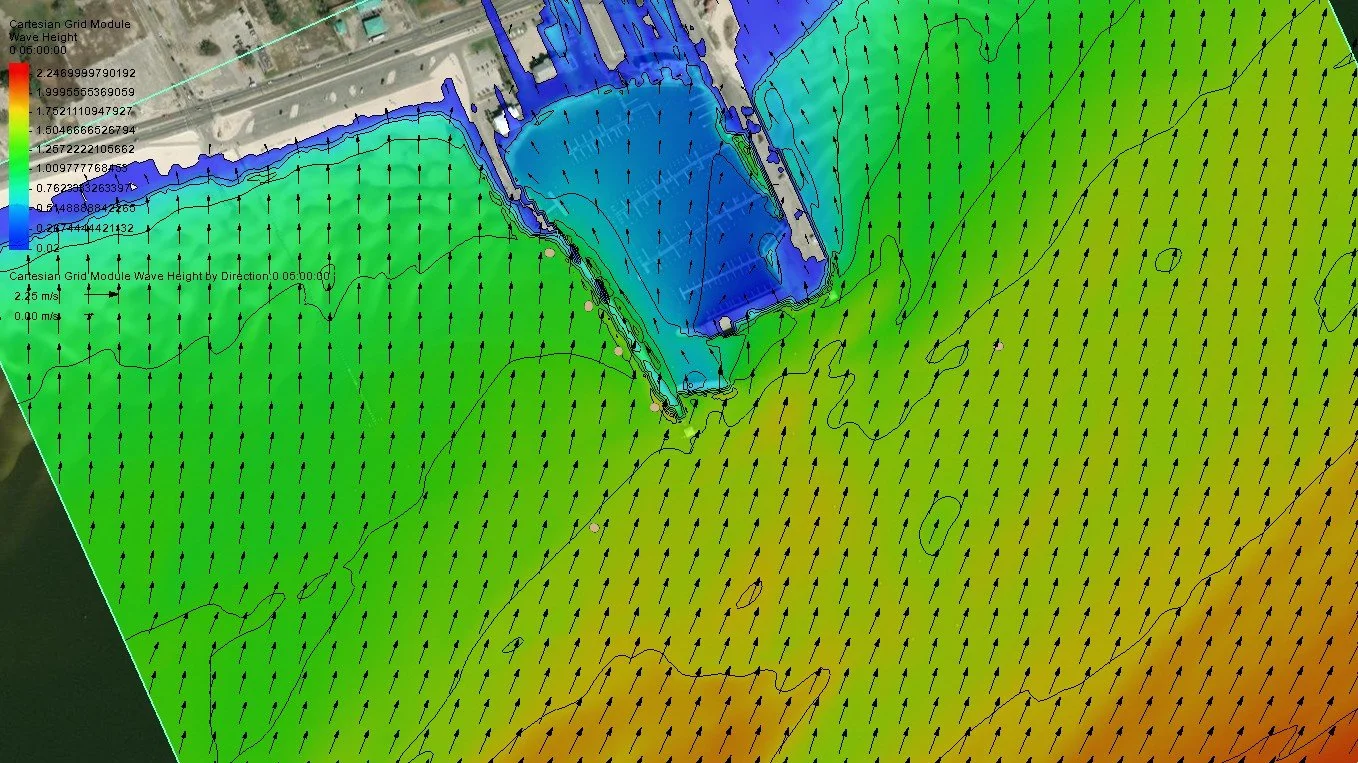
Wave and Current Modeling
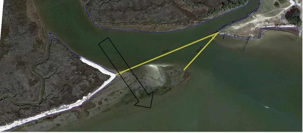
Coastal morphology and shoreline evolution
Sediment transport studies
Development of coastal stabilization strategies
Modeling sea level rise and marsh evolution
Coastal Geology Projects
Geoscience provided a range of wave forces on a raised seawall for Overstreet Associates. Waves were modeled using the Coastal Modeling System with wave values that were selected based on a 20-year review of hourly wave conditions and water levels. Wave forces were calculated using the Goda Formula for Forces on Walls from Breaking and Non-Breaking Waves and the Coastal Engineering Manual (CEM).
Resilience analysis and design for coastal flooding sources at interchange leading to Marine Base Parris Island.
The Phase I project used a small marsh island on the Whale Branch creek to model processes that control marsh health and evolution in the larger Broad River/Port Royal Sound habitats.
This study details the degree that the forested and palustrine forest floodplains along the Black, Waccamaw and the Pee Dee Rivers are contributing to lower flooding for crops and infrastructure in the basins.
This pilot study examined the water storage/flood resiliency value of lands upstream of urban/suburban centers under riverine dominated flooding. The goal was to develop a process that could be applied to other areas in the Southeast US.
Geoscience Consultants worked with the Lowcountry Council of Governments (LCOG) in developing a forward looking watershed management plan for five watersheds in the Lower Savannah. The area is directly adjacent to a major freshwater withdrawal that provides water to hundreds of thousands of people.
This project focused on identifying the potential infrastructure problems that will exist as sea level rise (SLR) occurs and determining how those effects can be minimized or mitigated to ensure that the needs of both the local communities and the military facilities are accommodated. This is particularly significant in the Beaufort area due to the fact that water and sewer services are provided to the military facilities by the same regional provider that serves the local communities; and local roads, highways and bridges provide the only access to MCAS Beaufort and MCRD Parris Island.
Geoscience Consultants was hired to examine sediment transport into a local navigational channel. The study revealed that a cause of the siltation in the channel was actually a lack of sediment. This study highlights the intertwined nature of coastal habitats and human use.
Geoscience performed a technical review of marsh migration models, the fundamental data sets and various parameters that drive model outputs.
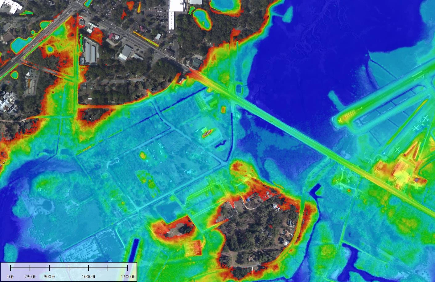
The North Coast project in Georgetown and Horry Counties (SC) grew from TNC’s Coast Summit in 2016 where riverine flooding was highlighted as a problem that held opportunity for nature based mitigation projects. Geoscience Consultants was hired to provide an understanding of localized flood risk at present and under future climate change. This information will help community stakeholders identify locations where green infrastructure can be used to mitigate increasing flooding issues.